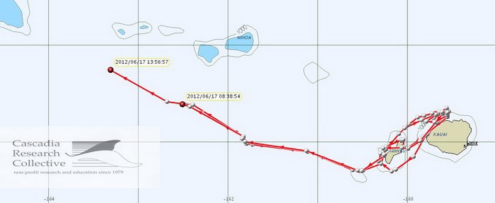
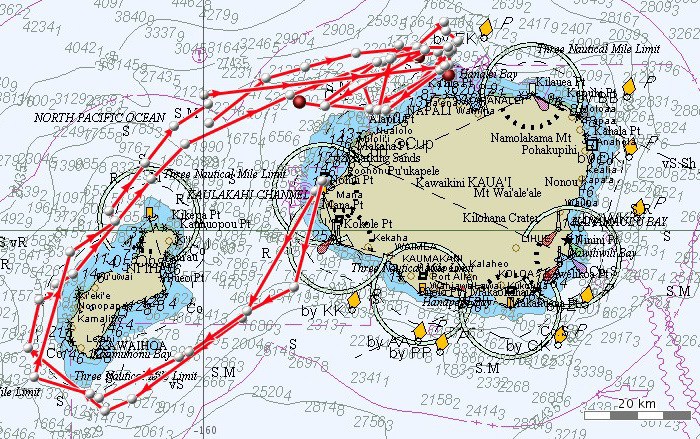
Cascadia Research will be undertaking a 3-week field project off the island of Kaua‘i starting June 12th, 2012. This will be our 7th field project (and 5th year) working off Kaua‘i and Ni‘ihau. The primary purpose of the project is to obtain information on movements and habitat use of a number of species of toothed whales through the deployment of satellite tags. We will also be obtaining photos from most species of odontocetes we encounter, to contribute to ongoing studies of residency patterns and social organization and to estimate population sizes. We will also be collecting biopsy samples for toxicology and genetic studies. Last year we had a similar project in July and early August (download a report from that effort here), and like last year we expect to have higher encounter rates than normal since we’ll be working in collaboration with the Marine Mammal Monitoring on Navy Ranges (M3R) program, using the Navy’s hydrophone range off Kaua‘i (see map below) to localize animals. When on the water we will be in constant contact with Navy researchers from the M3R program to help direct us to groups that they are detecting acoustically. This will allow us to confirm the species (to aid in using the acoustic range for research purposes on different species), and should make it much easier for us to find groups of whales and dolphins for tagging, photo-ID and biopsy sampling.
Species that we are hoping to satellite tag include rough-toothed dolphins, bottlenose dolphins, false killer whales, short-finned pilot whales, melon-headed whales, pygmy killer whales, sperm whales, Cuvier’s beaked whales, and Blainville’s beaked whales.
The research team includes Daniel Webster, Jessica Aschettino, and Robin Baird of Cascadia, Jeff Hogan of Killer Whale Tales and a number of volunteers. This work is primarily being funded by a grant from the Naval Postgraduate School (funded by N45), as well as additional support from Commander, Pacific Fleet.
July 2, 2012 update
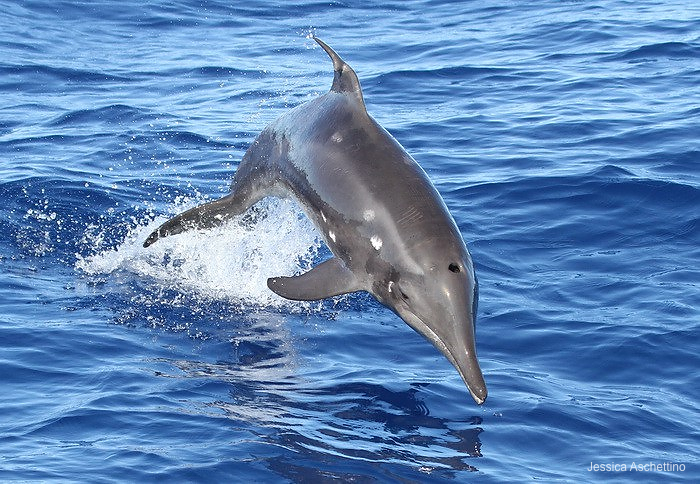
Rough-toothed dolphin leaping, July 2, 2012. Photo (c) Jessica Aschettino. This individual has an injured dorsal fin, with the top of the fin tilted to the right.
Today was the last day of our 3-week field project. Over the three weeks we had 67 sightings of six species, including 34 sightings of rough-toothed dolphins, 15 sightings of bottlenose dolphins, 10 sightings of spinner dolphins, 2 sightings of false killer whales, and single sightings of pilot whales and pantropical spotted dolphins (plus 4 sightings of unidentified dolphins). Over the 3-weeks we deployed 8 satellite tags on three species, including another location/dive tag doday on a rough-toothed dolphin, collected 13 biopsy samples for genetics, and took over 18,000 photographs. Overall a very successful project and we are looking forward to location and dive data coming in from the satellite tags. Our next field project in Hawai‘i will be in August off Hawai‘i Island, check our web page for information on that project starting ~August 9th.
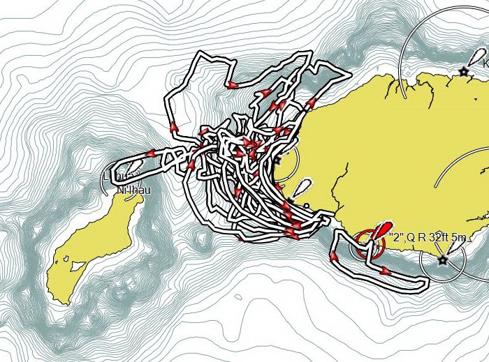
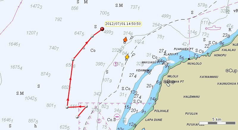
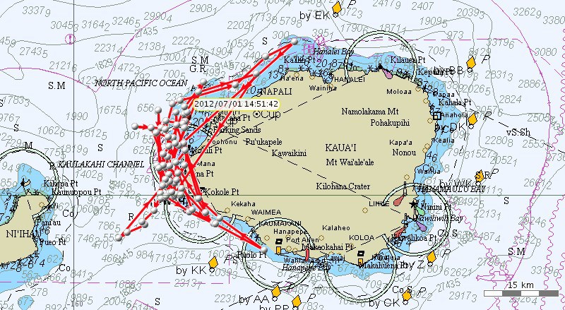
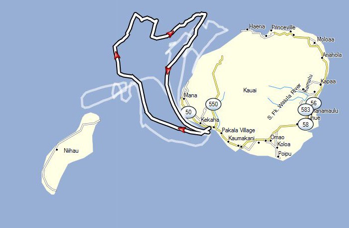
A map showing our tracklines for this trip.
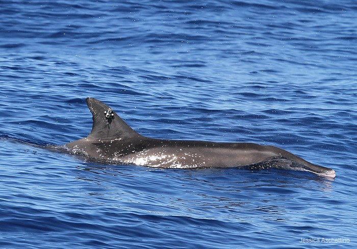
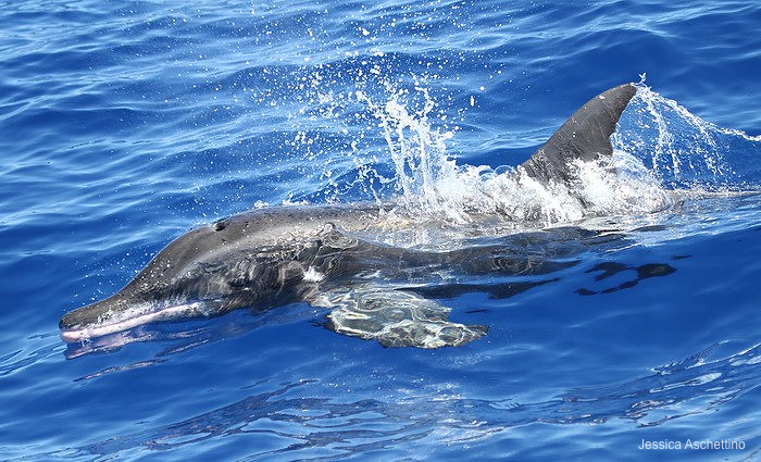
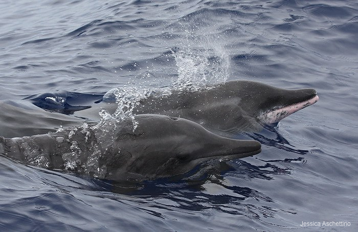
Rough-toothed dolphin with satellite (location/dive) tag on the dorsal fin, July 2, 2012. Photo (c) Jessica Aschettino
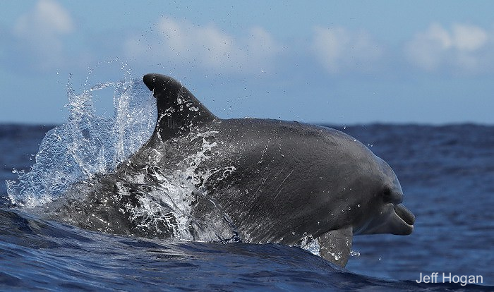
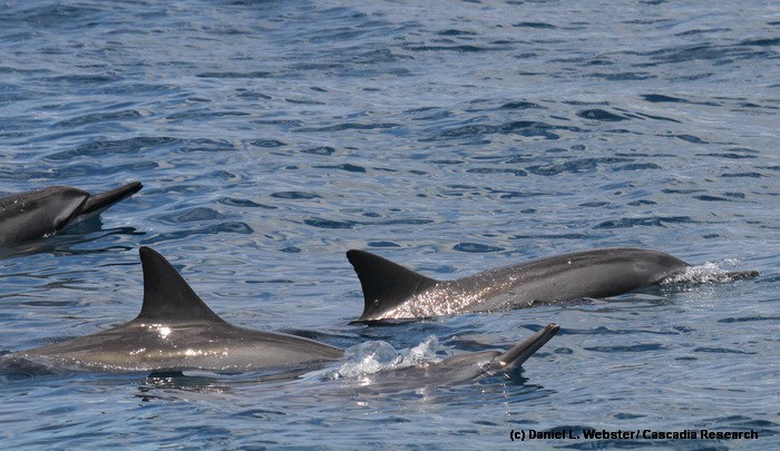
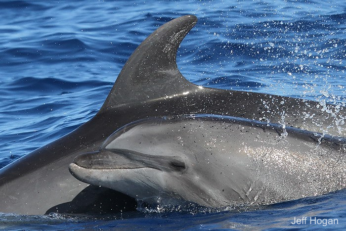
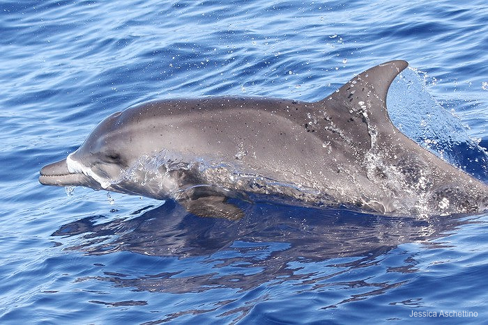
Bottlenose dolphin, July 2, 2012. Photo (c) Jeff Hogan
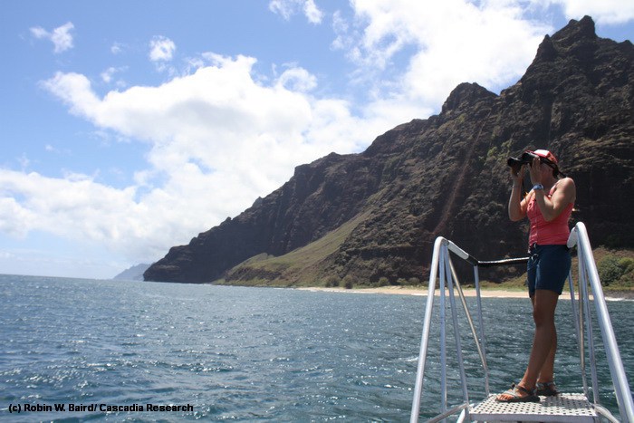
Scanning for dolphins off Na Pali, Kaua‘i, July 2, 2012. Photo (c) Robin Baird
Spinner dolphins, July 2, 2012. Photo (c) Daniel Webster
July 1, 2012 update
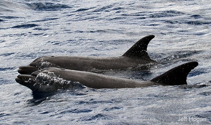
Bottlenose dolphins, July 1, 2012. Photo (c) Jeff Hogan
Wind forecasts for the last eight days have ranged from 15-25 knots, and our range, sighting rates, and productivity have all varied with the wind speeds, with from 0 to 3 sightings on the 25 knot days. The last two days forecasts have been for winds of 15 knots, giving us a larger area to work and a longer time period to work in it, resulting in more sightings and better conditions for tagging. Today we had 10 sightings of three species, including eight sightings of rough-toothed dolphins, and single sightings of spinner and bottlenose dolphins.
We were able to deploy a location/dive satellite tag on a rough-toothed dolphin today – the map shows locations in the first few hours after tagging, so are looking forward to getting dive data from this individual. The location/dive tags transmit information on the duration, maximum depth and shape of all dives over 30 m deep – assuming the tag works this will provide the first dive data from this species in Hawaiian waters.
Rough-toothed dolphin, July 1, 2012. Photo (c) Jessica Aschettino
Bottlenose dolphins, June 24, 2012. Photo (c) Jeff Hogan. On June 24th we also tagged a bottlenose dolphin with a location/dive satellite tag, and since then have been receiving both location and dive data from the tagged dolphin, the first dive data from bottlenose dolphins in Hawaiian waters. So far we’ve received information on 295 dives, with several dives over 400 m deep.
Map showing movements of the bottlenose dolphin tagged with the location/dive tag over the 8 days since tagging.
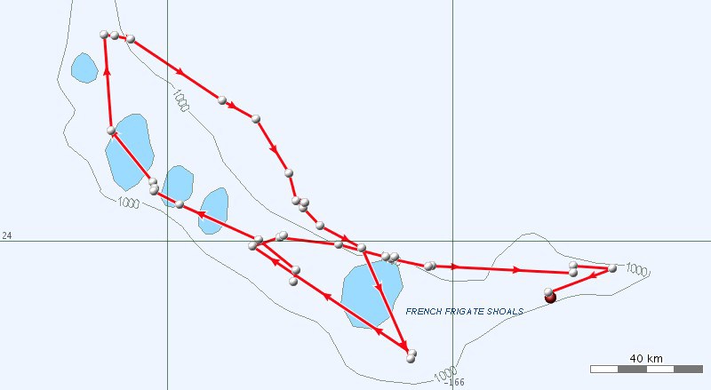
Map showing movements of one of the satellite-tagged false killer whales over the last three days. We are still getting movement data from the false killer whales tagged in the second and third day of the project – during the last two weeks they have spent their time in the eastern-third of the Northwestern Hawaiian Islands and are currently off French Frigate Shoals.
June 23, 2012 update
Although we’ve continued to have strong winds and a relatively narrow area to work in, we’ve had encounters with all three of the common species around Kaua‘i, spinner dolphins, bottlenose dolphins and rough-toothed dolphins, and have been able to photo-identify many individuals.
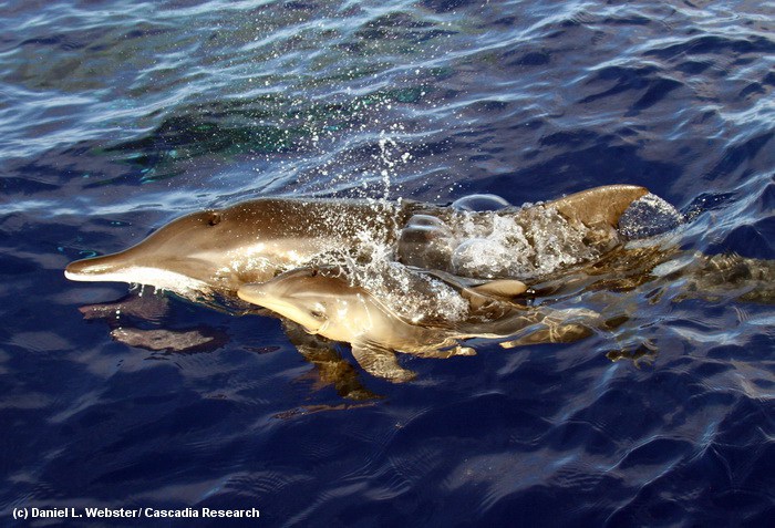
An adult female and newborn rough-toothed dolphin, June 23, 2012. Photo (c) Daniel Webster
The fetal folds on the newborn, vertical pigmentation marks on the side of the neonate caused by the folding of the fetus in utero, are clearly visible. Photo (c) Daniel Webster
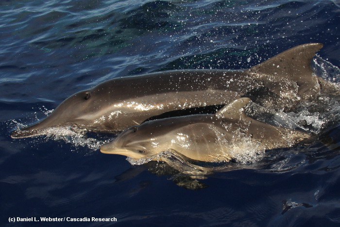
Three rough-toothed dolphins, June 23, 2012. Photo (c) Jessica Aschettino. The middle individual has a fresh wound caused by a cookie-cutter shark, and all three have scars from numerous healed cookie-cutter shark bites.
June 21, 2012 update
Locations from the satellite tags deployed on the three false killer whales strongly suggest the individuals are from the Monument population (see below).
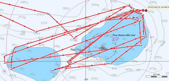
A map showing movements of two of the three tagged false killer whales over the last three days, showing only high-quality locations.The small island visible is Nihoa, the eastern-most of the Northwestern Hawaiian Islands, within the Papahānaumokuākea Marine National Monument
Weather has remained poor and in the last two days we’ve had a few sightings of rough-toothed dolphins and spinner dolphins.
June 19, 2012 update
The last two days the weather has remained sub-optimal (e.g., forecast winds of 25 knots and at most only a few hours of workable conditions each day). In the first three days of the project we covered 464 kilometers and had 13 sightings; in the last five days we’ve covered only 372 kilometers with just 8 sightings (with no sightings on three of the five days). Today is supposed to be the peak in winds and they are projected to lessen tomorrow (to a forecast of 20 knots), so we are hoping for slightly better conditions. In the meanwhile, yesterday we did encounter two groups of bottlenose dolphins and one group of rough-toothed dolphins and were able to photo-identify many of the individuals present.
Rough-toothed dolphins, June 18, 2012. Photo (c) Jessica Aschettino
June 17, 2012 update
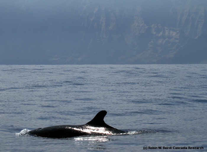
Although the weather conditions have deteriorated (forecast winds of 20 knots), we had a productive day on the water, with a sighting of our fifth species for the trip, a group of short-finned pilot whales.
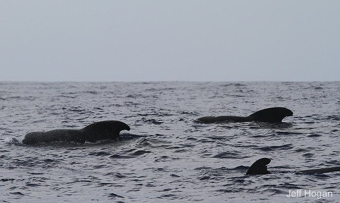
Three short-finned pilot whales, June 17, 2012. Photo (c) Jeff Hogan
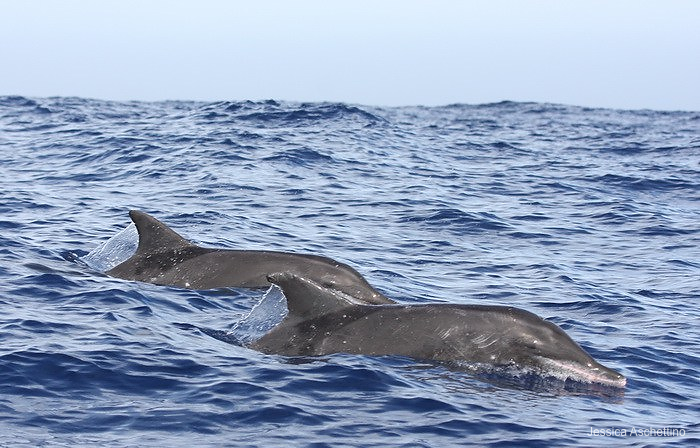
We also had several encounters with rough-toothed dolphins, were able to photo-identify more than 20 individuals, and we deployed one satellite tag, the fifth tag we’ve deployed on a rough-toothed dolphin in Hawai‘i.
Rough-toothed dolphins, June 17, 2012. Photo (c) Jessica Aschettino
Today the satellite-tagged false killer whales entered the Papahānaumokuākea Marine National Monument. The map above shows high quality locations only for two of the whales for the five days since tagging.
June 15, 2012 update
With a forecast of “winds variable less than 10 knots” we decided to launch out of Port Allen and head to the southeast, getting some effort in deep water to the south of the island, with the hopes of finding one of several deep-water species. Sadly the forecast was not particularly accurate and despite covering almost 60 kilometers of trackline we returned to the harbor with no sightings.
A map of the movements of the satellite-tagged false killer whales over the last three days, through late afternoon today (June 15).
Our tracklines from the first three days of our project, with yesterday’s (June 14) trackline highlighted. Most of the northern part (heading generally east) was during our encounter with false killer whales.
June 14, 2012 update
Prior to yesterday in field projects off Kaua‘i since 2003 we’ve covered over 8,300 kilometers of survey trackline on 80 different days in five different years, and we’d never seen false killer whale, while elsewhere in the main Hawaiian Islands we’ve encountered this species an average of once every ~2 weeks on the water. So it was definitely time. Yesterday, and again today, we encountered false killer whales, our highest priority species.
Mother and calf false killer whale, June 14, 2012. Photo (c) Robin Baird.
During the encounters we photo-identified more than 20 individuals, collected 11 biopsy samples for genetics and toxicology, and deployed three satellite tags. Although we’ve only had time to take some of the photos through our identification catalog, it appears these individuals are most likely part of the recently-discovered Northwestern Hawaiian Islands (NWHI) population of this species. That population was first discovered in 2010 during a NOAA research cruise, when two individuals off Nihoa were satellite tagged and a number of individuals were biopsy sampled and photo-identified. From the photos we knew that individuals did move from the NWHI to Kaua‘i (see report here on that work), based on matches with photos taken by the captain of a local snorkeling/sightseeing boat. Data from the tags deployed will provide the first detailed information on movements of individuals from this population around Kaua‘i and Ni‘ihau.
Two adult false killer whales, June 14, 2012. The close individual is likely an adult male – the front of the head of adult males is flatter, and adult males are larger than adult females. Photo (c) Robin Baird. We also obtained a number of laser photogrammetry photos to help estimate age class of individuals, and observed two fish chases/predation events.
False killer whale off of the Napali cliffs, Kaua‘i, June 14, 2012. Photo (c) Robin Baird
June 12, 2012 update
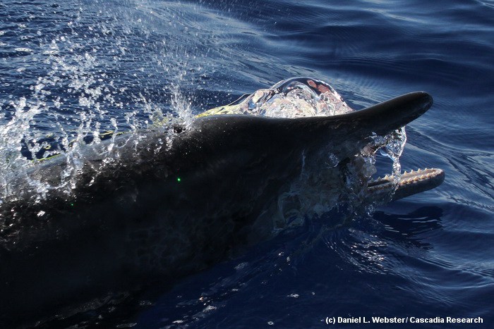
Rough-toothed dolphin with mouth open, carrying a mahimahi, June 12, 2012. Photo (c) Daniel Webster
Our first day on the water we covered 150 kilometers between Kaua‘i and Ni‘ihau, with two sightings of rough-toothed dolphins, and one sighting each of spinner and bottlenose dolphins. Although the weather was not quite as calm as forecasted we were able to have a productive first day, obtaining identification photos of about 10 individual rough-toothed dolphins, one bottlenose dolphin and a number of spinner dolphins, and collecting one biopsy sample of a rough-toothed dolphin.
Juvenile rough-toothed dolphin with a plastic bag in the mouth, June 12, 2012. Photo (c) Jessica Aschettino.
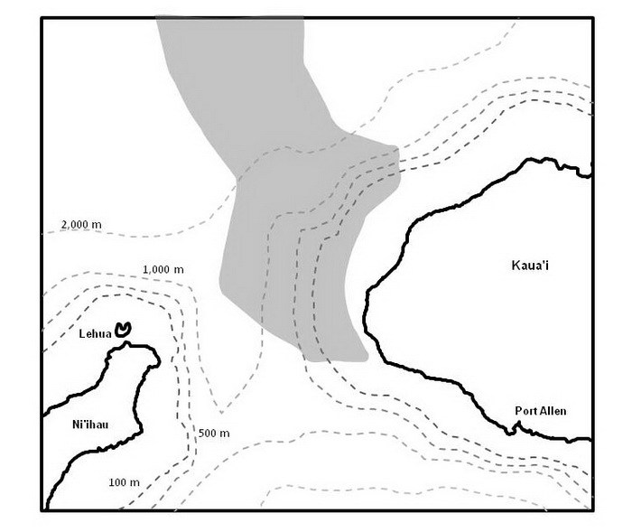
Our study area for the June/July project. The Navy’s hydrophone range it shaded – approximately 175 hydrophones are spread across the shaded area connected to the M3R system.